
What is remote sensing? What is the capability of remote sensing in environmental issues?
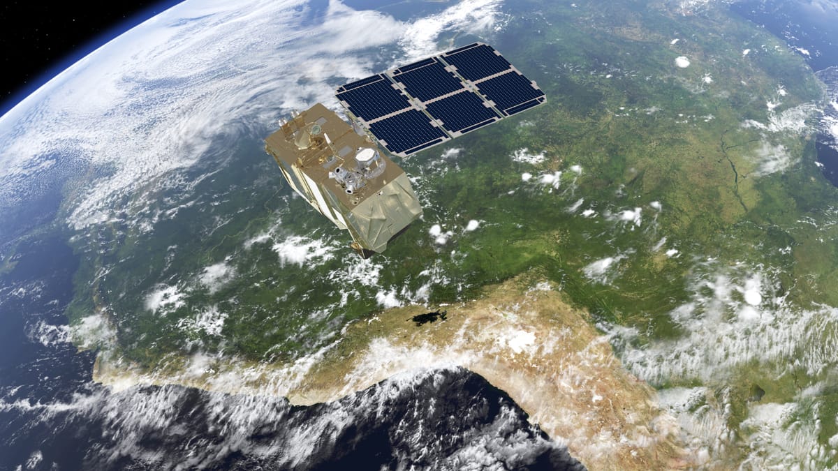
Remote sensing is the acquisition of data from a distance, and it has become widely used in multiple sectors, including individuals, research institutes, environmental organizations, the military, and governments across the world. According to the Fortune Business Insight, the global remote sensing satellite market is valued at USD 14.11 billion in 2023 and is projected to increase to USD 29.19 billion, indicating the surge of the massive demands of the market. This article will provide an introduction to remote sensing and it capability to explain this profounding technology.
What is remote sensing?
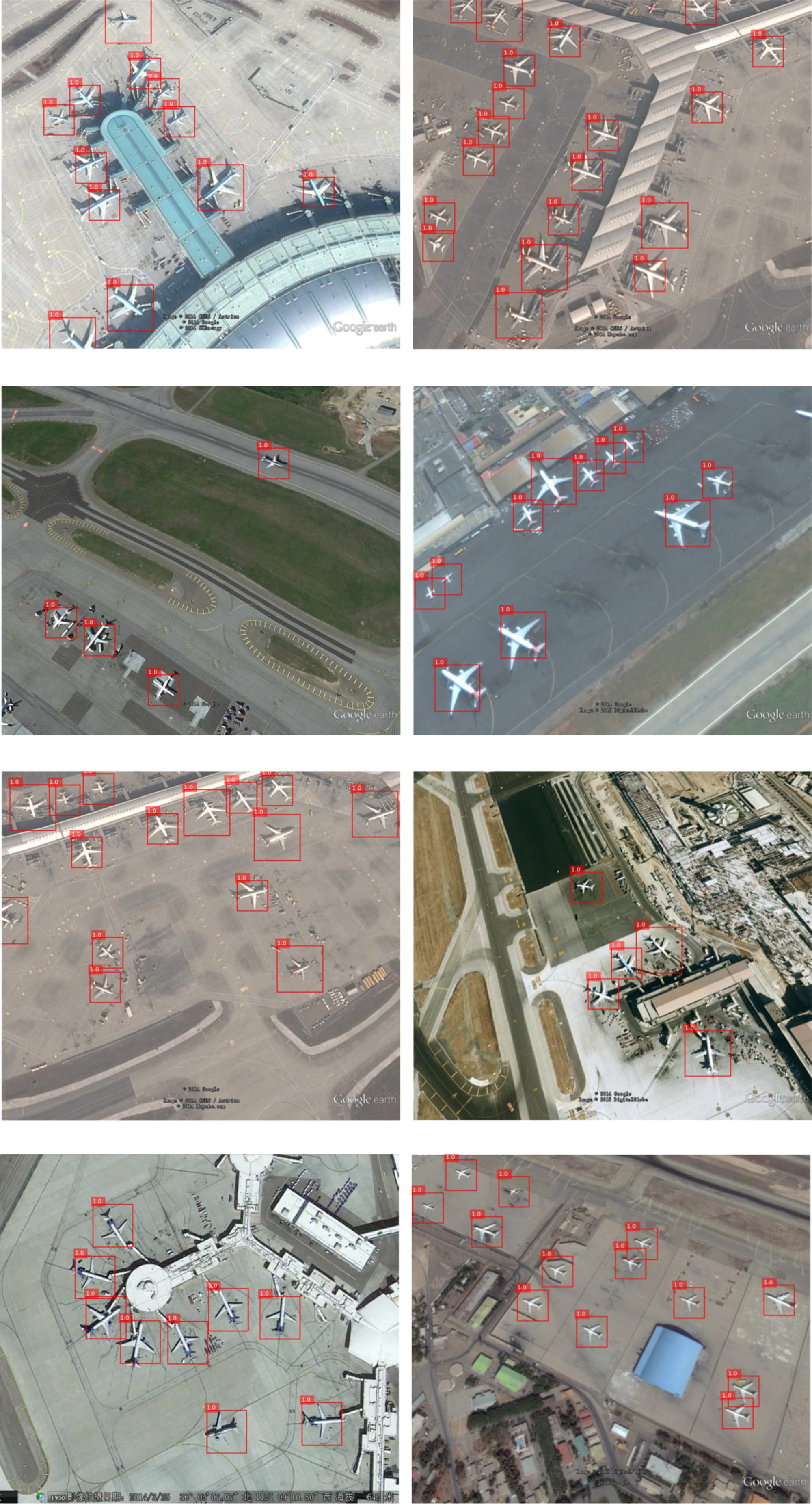
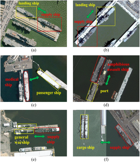
Remote sensing (RS) is a technique to collect data remotely, which means collecting information without physically contacting the object. It originally began with photography, a sensor technique we have known for a long time, and then started to develop during WW2, when radar (radio detection and ranging), sonar (sound navigation ranging), and thermal infrared detection systems were applied, and being operated for military purpose. Even now, RS and other geography information systems (GIS), or so-called ’’geospatial technology’’ still play a pivotal part in military operations. For instance, research showed the advanced capability of using satellite images to detect aircraft (Figure1) and military ships(Figure2), which improved the accuracy of specifying military targets.
Apart from those military usages, you might not notice that many of its applications are actually close to our daily lives. The Google Maps we use to navigate our way to destinations is one of the most common uses of remotely sensed data. It combines the satellite images collected by data providers like ESA(European Space Agency), NASA(The National Aeronautics and Space Administration), and Airbus with satellite or aircraft.
Weather forecast is also a common remote sensing application, which allows people to capture weather information and predictions. Many countries have equipped with their own weather satellites, including but not limited to the United States, European Union(EU), Russia, China, India, and Japan.
What is the capability of remote sensing in environmental issues?
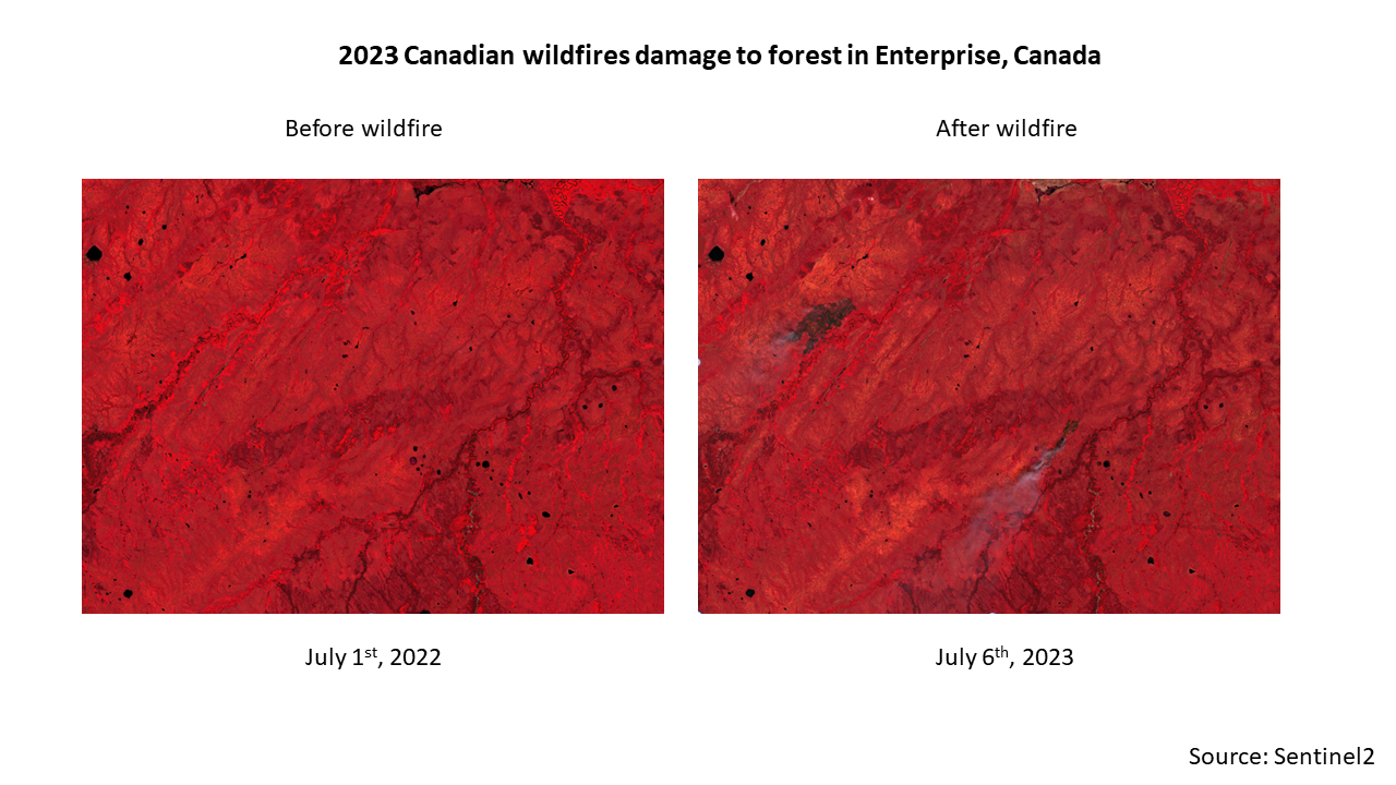
However, in the context of climate change and global warming, many of its applications are to solve environmental issues such as monitoring natural hazards like drought, flood, wildfire, volcano, and earthquake. For example, by looking at the satellite imagery before and after the wildfire, we can clearly found the changes in the forests that are burned.
The figure below illustrates the differences between mid-2022 and 2023, when the wildfire in Canada’s outbreak was in March 2023. It is also important to know that chlorophyll from vegetation is responsible for photosynthesis by absorbing red and blue light and reflecting green and NIR light. That is why the trees look green in our eyes. However, to better observe the vegetation (forest, crops) patterns, we use ‘False’ color for better visualization and color contrast. The more ‘red’ it is from satellite images, the more ‘green’ it is in reality because healthy vegetation absorbs more visible red light. Therefore, in the satellite images below, you can see that before the wildfire, most areas appear very red, indicating healthy vegetation. After the wildfire, some parts of the forests appear black, showing the areas that have been burned.
Furthermore, we can quantify how much human activities (agriculture expansion, deforestation, reforestation, etc.) have impacted the land cover by using annual land cover maps, which are also based on satellite imagery over time. By exploring remote sensing, you can uncover the world from new perspectives, revealing details on different scales and scopes.
Reference
Fortune Business Insights (2024). https://www.fortunebusinessinsights.com/remote-sensing-satellite-market-107838
Liu, Q., Xiang, X., Wang, Y., Luo, Z., & Fang, F. (2020). Aircraft detection in remote sensing image based on corner clustering and deep learning. Engineering Applications of Artificial Intelligence, 87, 103333. https://doi.org/10.1016/j.engappai.2019.103333
Moore, G. K. (1979). What is a picture worth? A history of remote sensing. Hydrological Sciences Bulletin, 24(4), 9. https://doi.org/10.1080/02626667909491887
Qin, P., Cai, Y., Liu, J., Fan, P., & Sun, M. (2021). Multilayer Feature Extraction Network for Military Ship Detection From High-Resolution Optical Remote Sensing Images. IEEE Journal of Selected Topics in Applied Earth Observations and Remote Sensing, 14, 11058–11069. https://doi.org/10.1109/jstars.2021.3123080